Flight Data Visualization
Flight data visualization (FDV) is a tool set for simulating a vehicle's
flight in both a two and three dimensional space. Allowing easy
interpretation of a flight in real-time from a local or remote
location. The flight information is stored for later re-play
for analysis and record.
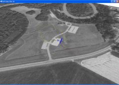
A 3D flight data visualization system is highly useful for
vehicles such as unmanned aerial vehicles (UAV)
(also referred to as remote controlled aerial vehicles),
RC airplanes and general aviation vehicles.
We have been building and operating a FDV systems as early as
2002-03, allowing us to remotely monitor and control very small
modified radio controlled airplanes. The latest FDV systems
provided a short range live video stream from the airplane
along with a 20 mile wireless telemetry link for onboard
sensor data for both 3D and 2D rendering of the airplane over
a satellite terrain image. The telemetry link also provides
long range airplane control via "tunneling" the radio control
data over the telemetry link.
For more on field test flights, see the field test pages.
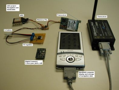
Navigation Sensors and Software
The FDV and UAV airplane navigation system consists of a GPS
receiver providing position, heading, speed, and elevation.
A 2-axis digital compass provides yaw. Accelerometers, gyros or
infrared sensors provide pitch and roll. A pressure sensor
provides additional elevation information.
A 20 mile telemetry link provides the navigation data feed
to the control center software.
A Wireless camera provides a short range video stream.
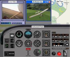
The control center software package displays:
Live streaming video
3D model representation of airplane over a satellite terrain
map
2D map showing current expedition path
Airplane instrument panel
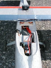
RC Airplane onboard navigation system:
First prototype using custom and OEM hardware:
Full size picture here
|
|
|
|
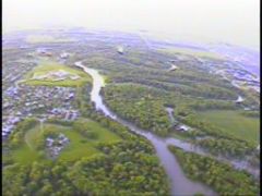 See video and photots >>>
 See larger concept photo